TRAVELS, TIMES & TALES from the TRAILS


Tuesday, October 19, 2010

Parnka Point to Loxton Sunday 17th October 2010


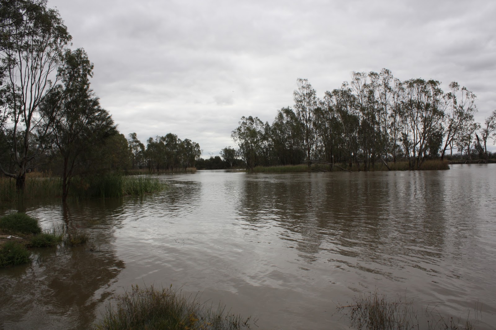
The road from the Coorong to the Murray was our longest day of driving. We left the ocean and drove north along the South Australian/Victorian border through Tailem Bend and the inland past patchwork quilted fields of canola and wheat. There were lots of small rural towns along the way with large herds of cattle and flocks of sheep. Eventually we arrived in Loxton the first of the towns along the mighty Murray river. Loxton is next to Berri only ten kms between them. It had been very wet in the past few weeks, with flash flooding along the river so the riverbanks and hence most of the free camping sites were washed out or very wet. At Loxton is the tree of knowledge, a large old river red gum which shows the historical dates of the river levels over the years, including the dramatic 1956 flood.
As our chosen river camping site was inaccessible, we found another great site called Rilli Reserve. It was next to the boat ramp which the locals used to check their yabby pots. Dale did a spot of fishing, however the fish were biting last week!!
The level of the river was still up and was flowing quite fast.  When we woke the following morning the mist was just rising over the river leaving an ethereal feel to the new day. It was silent, peaceful and very beautiful. Who wouldn't want this view from their lounge?

Mt Gambier to Parnka Point - On the Coorong Saturday 16th October 2010

 
As we left Mt Gambier, we called in at the Umpherston Sink Hole on the outskirts of the town. This hole was once a cave which collapsed forming a sink hole and creating the perfect environment for a garden. There is a large overhang of rock and a waterfall. It is floodlit at night and is quite remarkable. After quite a freezing cold night, the sun shone again and we moved on..


 As we wound west along the Coorong,which is the scenic gateway to the Limestone coast and takes its name from the Aboriginal word Karangh which means narrow neck. It is one of Australia's most fragile ecosystems with almost 47,000 hectares of stunning scenery. Along the way we stopped at Millicent, then Beachport which boasts the longest jetty in the southern hemisphere. It was quite windy and still cold so we declined the long walk out along it.


We then drove further to Robe which lies at the southern end of Guichen Bay. It used to be one of the Limestone coast's busiest ports. The Cape Ombey obelisk was built in 1853  as a navigational guide to assist entry to the bay. However it didn't prove very successful with lots of ship wrecks ensuing! The present light station was then built which proved more successful.


The seas were quite rough and the rock formations along the coast quite spectacular. This rock arch had almost worn through and was in danger of imminent collapse.
 Our next stop was at Kingston SE, the home of the big lobster. The Cape Jaffa light station was originally located out at sea on the treacherous Margaret Brock Reef. It was dismantled in 1970 and moved to Kingston. Regarded as an engineering feat, it was the only offshore lighthouse which had light house keeper's quarters.
As is usual for us... the rock lobster was out of season and not available.

As it had been a long day, we began to look for a campsite. We diverted to Jack's Corner which was the largest pelican breeding ground on the Coorong. When we got out of the van, the stench of the mangroves hit us hard. On the ground were thousands of black leeches. It was a unanimous decision to get back in and move on...  Eventually we found a superb spot called Parkna Point. The view was spectacular and we only had one other camper there. We backed into our pitch and poured the wine!!  Another great back window view!

Friday, October 15, 2010

Fitzroy River to Mount Gambier Friday 15th October 2010


We next went to Cape Nelson, out from Cape Bridgewater.  On the road out to the Lighthouse there is a huge wind farm of about 20 wind mills. The light house is quite solitary and the wind almost blew us off the cliff.
At Cape Bridgewater, there is a formation known as the petrified forest. Some believe it is a forest which was petrified by water and limestone which has only left the truck formations. Other authorities believe it is a stone formation similar to staligtite formations. Either way it is pretty impressive. Like a lunar landscape.
Nearby are freshwater lakes and huge caves. It is a steep 50 mt climb up to them but the views are great from the top.
On our way to Mt Gambier we caught two emus walking down the road to the highway. One more iconic oz animal to cross off the list!
We finally reached the Vic / SA border and won't return to Vic until later this week when we hit the Murray River.

In Mt Gambier city centre is a cave garden which is essentially a sink hole which has been developed into a beautiful garden. You walk right down into it.


Unfortunately, the Blue lake wasn't as blue as it should have been due to the wet weather. However it still had its impressive turquoise colour. It was very cold and wet. Hopfully the weather will improve by the time we head north to the Murray.


Port Campbell to Fitzroy River Thursday 14th October 2010

After leaving Apollo Bay, three more rock formations are found. Firstly The Arch;
then London Bridge, half of which fell down...
Then the Grotto, a still mirror pool which is only refreshed by high tide or very big waves..
The next impressive display is the Bay of Martyrs..
closely followed by The Bay of Islands..

At the end of the Great Ocean Road is Warrnambool. Flagstaff Hill is a maritime village which has been lovingly restored. The lighthouse was out on an island off the coast and was disassembled and rebuilt here and is still a working light station today.

We spent the night at another awesome free site at the mouth of the Fitzroy River, just east of Portland. We parked up close to the river's edge another great back window view. During the night the tide came in and when we woke the water was lapping the edge about a meter behind the back wheels. Quite different to this view!

Wednesday, October 13, 2010

Lorne to Port Campbell via Colac Monday 11th / Tuesday 12th October 2010

After leaving Lorne we went to the Erskine Falls a mere ten kms up the road. Up being the most important word! We hadn't realized (as no-one had told us) that the road into the falls was straight down, a 1/6 gradient. Of course "the barn" couldn't go down, so we parked 1 km from the falls and walked in. What a joke! It was hard yakka going down so you can imagine how hard it was coming back up! Meanwhile the falls themselves were beautiful - lots of water flowing and stunning rainforest. We were exhausted when we got back to the van and it was only 9 am!

We had planned to go on to Beauchamp falls and free camp at the falls carpark for the night. However, once again the road was very narrow and winding and totally unsuitable for large motorhomes. Instead, we decided to journey on to Colac. We had no idea what was there except for a large inland salt water lake and a volcano crater. What a great decision, we made. It was one of the best days we have had.
After stopping at the Information centre, we went out to Red Rock about 5kms out of Colac. The view was amazing. It happens to be a volcanic area and there are craters and lakes and sinkholes everywhere. We climbed up to the top of the crater edge and despite almost being blown off the edge managed to take some great photos.

Around the surrounding paddocks are fabulous dry stone walls which are quite historic. Apparently the granite from the volcanos was used to build the walls which have been kept intact in most areas. They are very skillfully made.
We took a scenic drive around the lakes, which are the largest permanent salt water lakes in Australia. We knew of a campsite called Meredith Park about 5kms out of town on the edge of the lake. When we arrived (via our GPS exact locator) there were about ten other campers there already. The grass needed mowing, but hey free is great what is a little high grass between friends! We parked up and enjoyed a vino beside the lake. Bliss!!  Fresh water and clean amenities and good travellers to share stories with.


The lake was teeming with flocks of swans who were very inquisitive. When they flew off, thier silhouettes were in perfect symmetry.

The sunset was golden and perfect and the place heavenly. Peaceful and serene, a good ending to a perfect day.


The next morning we journeyed back to Lorne. Dale had bought a Lottery ticket a few days previously and when we checked it at the Newsagent he had won a good prize. The next days entertainment and fuel were paid for in advance.

On the way to Cape Otway we went on a small rainforest walk at Maits Rest. It was completely boardwalked and very pretty. The largest tree ferns we have ever seen.
After coming back to the coast from the hinterland, we went out to the Cape Otway Lighthouse. Again this precinct is well worth the time spent. The whole area is set up as it was originally with museums and cottages open for viewing. We climbed the light house where the views of the rough seas were great.


While we were up in the lighthouse the rain began to fall. We could see it coming towards us across the bay in great sheets.
We got caught in a downpour and were very wet. Whilst everyone else sat in their cars, cold and dripping before the long trek back to town, we got changed and had hot soup and coffee in the carpark within 15 minutes. We sat back warm and dry and just grinned!  How good is motorhoming!!
On the road leading into the lighthouse were lots of koalas all quite active due to the wet cooler weather.
The road with the misty tree tops was quite ethereal and picturesque. This photo is one for our wall, when we get home.


We eventually reached Apollo Bay and decided to stay overnight in a caravan park. It was wet and cold and we needed to get warm. The heater in the van works very well! We went for a walk between showers onto the rocks which were very slippery and wet. Out to sea just off the beach was a group of seals swimming around a rocky outcrop. They didn't mind the wet conditions at all.
The next morning, we  proceeded to Lavers Hill and then to The Otway Fly. This is an elevated walkway up in the treetops. The views are amazing and well worth the visit. It had railned heavily most of the night so we expected to have a misty grey day. However, it turned out to be quite the opposite. The rainforst was teeming with life and the waterfalls and creeks flowing.


It is quite different seeing the trees from above. Mostly, you look at trees from the trunk side up and when you see them from the top down it gives quite a different perspective altogether. The towers and elevated walkways are amazing feats of engineering.
After leaving the fly, the twelve big rocks were next. This is the first of the apostles and the others followed in succession and yes there are still 12 big rocks!!  Unlike the leaning tower of Pisa which was much smaller then we had imagined, these were much larger than the pictures intimate. They are quite daunting when seen in rough seas as we did. The power of the waves on these formations is quite something to watch.


At  Loch Ard Gorge is an old cemetary where the four bodies recovered from the wreck are buried, There is also a plaque listing the names of the people not recovered. Somehow the small cove does not do justice to this terrible shipwreck. It seems to be so beautiful and sheltered.